

20 years of OpenStreetMap: On a par with Google Maps and Apple Maps
When OpenStreetMap was founded, it was only known to a handful of activists. In the meantime, the globe is almost covered and OSM is not only useful in crises.
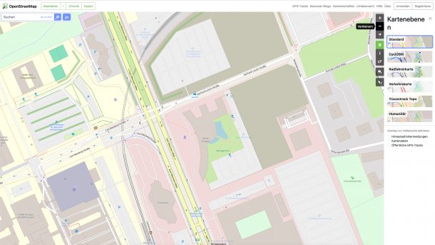
OpenStreetMap knows one of the most beautiful spots in Hanover and a real insider tip: the Heise Garden.
(Image: Screenshot)
On August 9, 2004, a few idealists registered a domain for their small, inconspicuous map project. A few years after Wikipedia, OpenStreetMap (OSM) saw the light of day with a similar approach. At 20 years old, OpenStreetMap.org has outgrown its teenage years and has established itself as an open alternative to the map services of Google or Apple.
In the years following its foundation, the project remained largely unknown. The focus was on the United Kingdom, where a community developed. The pioneers of that time could only dream of today's global expansion. In Germany, OpenStreetMap only became reasonably well known in 2006. The project first appeared on heise online in August 2007.
In the beginning, OpenStreetMap struggled. It was to become a freely available map service in times when hand-drawn and printed maps dominated navigation. Moreover, map services on the Internet did not yet have the significance they have today.
Videos by heise
The hurdles for creating maps are not exactly low: streets, points of interest, house numbers, power lines and more had to be recorded and mapped. Once you understood the OSM editing system, you couldn't just start typing away, you had to get to grips with the subject matter.
Sometimes more, when it came to creating new content, and sometimes less, when it was just a matter of correcting errors, for example. In the early days, many people were still walking around with GPS trackers to record roads, paths and/or other buildings.
Data donations from the USA
In the early years, data donations were of enormous importance. In 2006, for example, Yahoo Maps made it possible to trace roads in OpenStreetMap on the basis of satellite data. This was an enormous help, especially if the community did not exist locally, which in 2006 was still the case for almost the entire globe.
An important milestone was the import of open data from the US government (Topologically Integrated Geographic Encoding and Referencing, TIGER) in 2007. In one fell swoop, the OSM community had access to a huge road data set. Within a few months, the USA was mapped, albeit not always in the best quality. 2007 was also the year in which the German community really got going and was soon larger than the community in the UK.
Everything that is somehow recognizable is now mapped, as long as someone in the community can be found to do it. In the standard view, OSM shows roads first and foremost. However, footpaths and above-ground railroad lines, which other map services like to draw as light grey, sometimes barely recognizable lines, are clearly visible. OpenStreetMap quickly became much more than just a street map. The name is actually somewhat misleading, but "OpenEverythingMap" would not be a good solution either.
As data quality increased, so did its use by other projects. This also happened on a commercial level. In 2009, for example, the X-Plane dev team decided to use OSM data for version 10 of the flight simulator, and Microsoft's flight simulator also uses the data - with sometimes bizarre effects.
This made it possible to fly on sight over German cities using only the street positions. Although the buildings were still purely random, flying over your home town and finding the city you worked in or the street you lived in was suddenly no longer a problem. Gone were the days of random street systems.
